Serpents, Circles, the Bermuda Triangle and "Terra Australis": an Atlantean puz
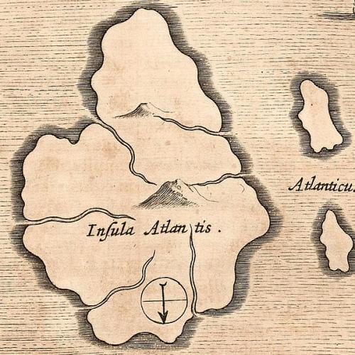
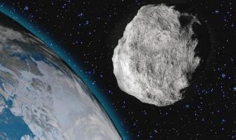
In my last article (https://www.neperos.com/article/rt54zid8ab568566) I speculated that Avebury Circle could symbolise the Andean location of Atlantis, or that the smaller henges within were Poseidia and Antillia, the two Caribbean Atlantean islands. But couldn't the "Serpent" have represented something other than Andes or the Mid-Atlantic Ridge? In the Winged Disc article I said that comets were often called "flying serpents", mainly, I suspect, due to their tails, and that the destruction of Atlantis could've been precipitated by a close planetary "fly-by". [As a result of gravitational forces causing major natural catastrophes]. Well, Otto Muck in The Secret of Atlantis, London, 1978, gave a graphic account of the different stages of its demise following a direct asteroid strike.
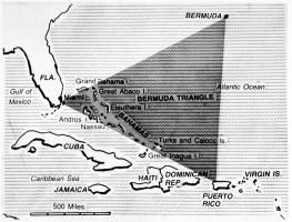
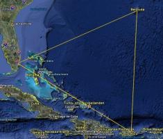
Regarding the impact of "Asteroid A", which he dated to 5 June 8498 BC, Muck said that while the main section hit Atlantis [which he located Mid-Atlantic], two smaller chunks punctured the Caribbean sea floor and are now visible as 'blue holes'. Incidentally, they are in the central Bermuda Triangle. Could meteoritic iron in the Earth's crust be a reason for the strong magnetic properties of the region? [But bear in mind the Caribbean location of the submarine Atlantean pyramids, domes, and other structures mentioned in my first article.] There is also a crater field near Charleston, SC., where even smaller pieces scarred the ground.
The location of Atlantis has been much debated, though I favour Charles Hapgood's theory that crustal displacement [I think caused by the "fly-by" or impact disturbing Earth's axial alignment] shifted the main island 2,000 miles further south. In earth-crust displacement the planet's "outer skin" moves in one piece, rather than as individual plates. Thus, as the Flem-Aths believe [their theory detailed in When The Sky Fell: In Search of Atlantis is well worth reading] Atlantis now lies in the present position of Antarctica. Graham Hancock in Fingerprints of the Gods [pgs. 495-6] wrote that, if this was indeed the case, then
"it was possible that the substantial remains of a lost civilization of remote antiquity might today be lying under two miles of ice at the South Pole."
Hancock discusses several maps depicting Antarctica in successive stages of glaciation. [Hapgood said that displacement caused "the mysterious surge and ebb of Antarctica's vast ice sheet".] These cartographic oddities are:
- The "Piri Re'is" map of 1513, said to have belonged to a Turkish admiral, and found in the Topkapi Palace, Istanbul, in 1935. The N and E coastlines of S. America are accurately mapped [N. America and the Caribbean less well]. According to Eric von Daniken, S. America is shown joined to an ice-free Antarctica! [Remember this is before the"discovery" of a passage around the tip of S. America and the Pacific Ocean by Ferdinand Magellan in 1519.]
- The southern hemisphere by Oronteus Finaeus [1531], showing Antarctica with ice-free coasts.
- An ice-covered Antarctica in a world map by Mercator [1569].
- The continent, again without ice, as drawn by Phillippe Buache in 1737, possibly, says Hancock.
"based on source maps made...perhaps thousands of years earlier than those used by ... Finaeus and Mercator" [pg 18].
Compare these with typical mid-sixteenth - early eighteenth century maps:
- Pierre Descalier, World Map, 1550: "Terra Australis Incognita"- a large southern landmass which philosophers believed balanced all the land in the northern hemisphere! It encompassed New Guinea, Australia and Antarctica [the latter two then "unknown"].
- Joan Blaeu, World Map, 1662-3: the establishment of Dutch trading centres in the Cape of Good Hope and Indonesia in the 17th century led to Australia and New Zealand being more thoroughly charted by mariners. The former is called "New Holland". New Guinea shown joined to Australia, California as an island!
- Frederick de Wit, World Map, 1668: NW, W and SW coasts of Australia, S Tasmania and SE (?) New Zealand charted, and no Terra Australis.
- Hendrick Doncker, Indian Ocean, 1705 [made for Dutch East India Company, founded 1602, and based in Batavia, Java, from 1619]: New Guinea and Australia still joined. This map is interesting as it shows how the Dutch progressively mapped Australia from 1616 onwards.
In 1770 Captain Cook found Australia's eastern coast [absent in the Buache map]. At the time, Antarctica was still "unknown". Cook's voyages in 1769 and 1770 proved that Terra Australis did not lie in the South Pacific. In 1772 his search further south led him to sail along the Antarctic ice shelf, and the following year, Cook made the first crossing of the Antarctic Circle. It could be said that he "discovered" Antarctica. But, if it wasn't for those maps, we might've continued to believe it!! [Yet, oddly, Buache depicts Antarctica joined to New Zealand.] Based on the four maps, Hancock concluded that, until 4000 BC, when ice finally completely covered Antarctica, it
"may have been continuously surveyed over a period of several thousand years as the ice-cap gradually spread outwards from the interior, increasing its grip with every passing millennia... ."[Fingerprints of the Gods, pg. 20]
The question is, mapped by who?


