The flooding of the Nile and the "Limo"
Everyone talks about it as an established fact but, who really knows what it is ?
There has always been in the history of the Ancient Egypt one peculiarity that I initially took for granted a little too passively: the phenomenon of the annual flooding of the Nile with deposition on the arable layer along its entire valley called "Limo".
It sounded "strange" to me that a flood could be defined as "beneficial" but, out of mental laziness probably, I accepted it as a "given".
Now, having tracked down some notes and arranged them to the best of my ability, I share them with you with immense pleasure.
A "SCHEDULE" of the Nile dating from 1978 thus describes it:
- Nile basin: 2,867,000 sq. km.
- Nile length: 6,671 km (Nile-Kagera) from source to delta; 3,700 km (White Nile, from Lake Victoria); 1,731 km (Blue Nile)
- Slope, Khartoum-Foce: 0.016 %
- Delta area: 2,300 sq. km
- Nile flow rate: 84 billion cubic meters/year at Asswan (1900-1960), 50 billion cubic meters/year at the mouth; 790 million cubic meters/day at flood time and 60 million cubic meters/day at lean time at Wadi Halfa
- Percentage tributaries (at Wadi Halfa): 80% Blue Nile, 15% Atbara, and 5% White Nile (at flood time); 83% White Nile and 17% Blue Nile (at lean time)
- Water rise in Cairo during flood: 8 m
- Debris load (silt) during flood: 1.5 kg per cubic meter
- Peak flood period in Lower Egypt: mid-September
- Irrigated area: 2.8 million ha in Egypt and 0.5 million ha in Sudàn
Between all earth's rivers, the Nile (el Bahr, "the river" par excellence) can place itself in the first positions, if not first. First and foremost, it is the longest river, stretching from the southern hemisphere of equatorial Africa to its mouth on the Mediterranean Sea over a course of 6,671 km. But what we are interested in pointing out is how this river was a fundamental pole of coagulation of peoples that evolved to make that fundamental contribution to the history of human civilization that was create the civilization and culture of Ancient Egyptian society.
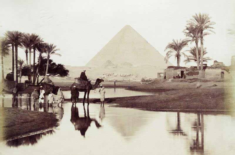
Two are the rivers which give rise by their skillful interaction, to the "miracle" of the Nile, even millennia before Herodotus announced its portents: the Blue Nile and the White Nile.
It then increases the effectiveness of the same by another tributary, the Atbara, which enters the river north of Asswan, between the Silk and Fifth Cataracts.
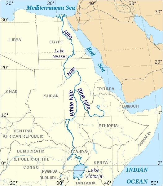
Let us analyze the two Nile's rivers.
The Blue Nile
It is the branch that has its sources in Lake Tana, in the Ethiopian acrocorus. Although it is the "shortest" of the main branches, it is the one that generates the larges amount of water. As it progresses it flows through canyons, generates waterfalls and flows bringing a heavy load of silt from the land (1.5 kg per cubic meter). Asperities are numerous throughout the basin.
Shortly after the exit from Lake Tana (at 1830 meters) it generates the spectacular Tisisat waterfall, which is then succeeded by a whole series of cataracts in the bend that bypasses the volcanic Ciokke mountain.
At about 500 meters, as it exits the Ethiopian plateau, the Blue Nile finally finds quiet in the Sudanese lowlands. A similar troubled course is analogous to the Tacazzè, which, under the name Setit, flows into the Atbara (the third major tributary of the Nile).
The White Nile
In contrast to the Blue Nile, so-so impetuous, the White Nile is a "quieter" river.
The White Nile originates in the highlands of East Africa, above the Rift (the great rift that cleaves East Africa), the Ruwenzori massifs (the mythical Moon Mountains of the ancients) and the other mountains that overlook the Great Lakes. The waters drained by these highlands end up in Lake Victoria, at an elevation of 1134 meters into which flows, on its western bank, among others, the Kagera River, which, with its Luvironza branch, draws its waters over the mountains of Burundi where conventionally Caput Nile is placed at about 5000 meters elevation.
From Lake Victoria flows what is called the Victoria Nile, past Ripon Falls and into Lake Kyoga (1033 meters).
Jumping across Murchison Falls (now Kabalaga) it reaches Lake Albert, the northernmost of the Rift Lakes, at 619 meters. The water supply from the Nile caused Lake Albert to open up on its northern side, and from here the waters continue their outflow through various waterfalls with the names first Albert Nile and then Bahr el-Gebel (mountain river).
All the way to the southern Sudàn depression. This territory can be defined as an "amphibious" area, subject to periodic flooding, intricate and rich in marsh grasses that the Arabs call Sudd (that's right, with a final double "d") meaning "encumbrance", "impediment", and which was identified by geographers of the past as "Lake No".
Our river flows here in a wide bend cut by the Bahr el-Zeraf (River of the Giraffe) to receive two new tributaries on its way out of this "slimy" area, at an elevation of about 450 meters, the Bahr el-Ghazal (River of Gazelles), from the left, and the Sobat from the right, to then quietly continue its outflow until it joins the Blue Nile at Khartoum.
The course of the Nile, from Khartoum (450 meters above sea level) continues without excessive slope, with a wide westward bend beginning after the locality of Abu Hamed, to the northern boundary of the Sudàn, broken by four cataracts, the 6th, 5th, 4th and 3rd (the 2nd was swallowed by the waters of Lake Nasser) until it enters Egyptian territory.
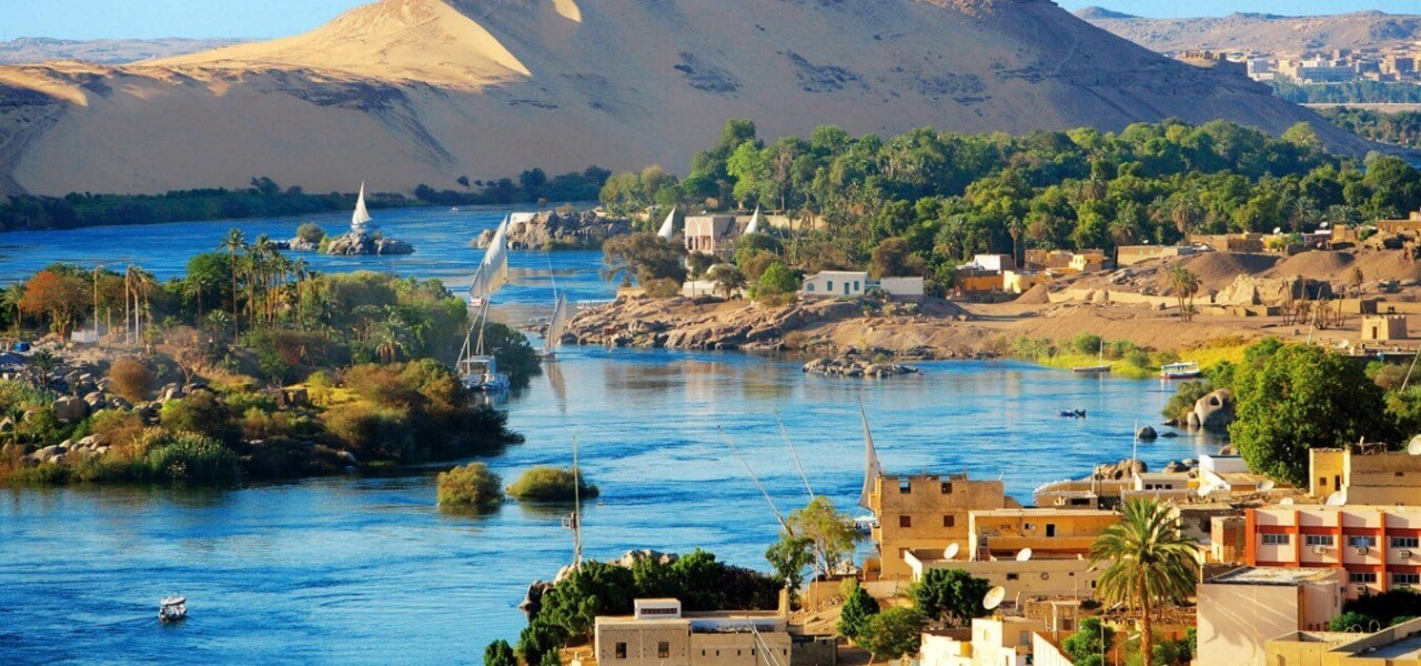
From this moment begins the part of the Nile's river that we are most interested in, without forgetting, however, that the phenomenon of its annual floods and inundations had also affected the preceding parts until the time of the construction of the High Dam and the formation of the enormous reservoir that is currently Lake Nasser.
From here, the Nile resumes its course toward the Mediterranean with a gradient of about 8 cm/km at first on the sandstone that cover the continental substrate of crystalline rocks (gneisses and granites, including the famous syenite already used by the ancient Egyptians for the construction of their monuments). The deep rocks, granite clusters, outcrop at Asswan in the splendor of the sixth and final waterfall, where the bright bubbling of rushing water merges its glimmer with the vivid pinkish-brown of the granite clusters.
But let's go back to what mainly interests us to delve into the many magics of this marvelous river, and analyze its constituent processes:
Abundant feeding at its origins
The long development of the Nile has its reasons not only in the particular conformation of the basin but also in the abundant food supply. It is largely confined to the upper section of the Blue Nile and White Nile watersheds, in the château d'eau of the equatorial highlands and the Ethiopian plateau, gradually reducing northward and disappearing altogether downstream of the confluence of the Atbara.
This is an exceptional fact, that is, the presence of a vein of water that manages to overtake, keeping itself plentiful, 2400 km of desert, thanks solely to the water it has drawn from distant lands.
But these lands are rainy.
The White Nile draws nourishment from the equatorial belt subject to the constant influences of the trade winds and thus with abundant rainfall reaching 2000 mm annually, distributed with some regularity throughout the year. In contrast, the Ethiopian Acrocorus has a tropical monsoon-type climate, determined by the seasonal (summer) pulses of trade winds linked to the sun's zenithal shifts. Given also the high altitude, about 1,500 mm of rain falls annually on the plateau, concentrated, however, entirely between April and September.
It is the big rains (cheramt) that cause the floods.
Descending into the Nilotic lowlands, the climate is entirely different and the rainfall lower. These fall to just over 150 mm in Khartoum, which lies in the "sahel" (the "bank") belt that demarcates the transition from savannah to desert. At A-tbara less than 100 mm falls, and from here to the Mediterranean it is all desert, in which the green belt of the Nilotic valley appears almost like a mirage: a long unbroken oasis.
A marvelous hydraulic device
The Nile's hydrological mechanism is the grandest and most ingenious on earth. The first to give a scientific explanation of it was, in the last century, the Italian engineer Elio Lombardini (1794-1878; for a long time working at the Magistrato alle acque in Milan and one of the first Senators of the Kingdom of Italy). As foreshadowed in the brief "fact sheet" above, the river brings 50 billion cubic meters of water to its mouth (at Asswan 84 billion); but the actual contribution varies according to the seasons. The largest contribution is due to the Blue Nile, to which it also owes the flood (during which it provides 80% of the tribute, the Atbara 15% and the White Nile the remaining 5%).
Such a high input of the Blue Nile is due to the fact that the precipitations that occur on the plateau immediately turn into a single river course; little water is retained, limited evaporation: the silty current descends to the lower Nile plain without delay. The White Nile is affected by the more regular rainfall on the Ugandan highlands throughout the year, although here too there are stable highs and winter lows.
But the river is interrupted by Lakes Victoria, Kyoga, Albert and finally the vast swamps of the Sudd: these are as many elements that act as condensers, sort of flywheels that restore regularity to the river.
The Nile, however, at this point finds itself losing a large portion of its water (about 50 percent as it exits the Sudd) due to evaporation.
Further on, the White Nile receives the water of the Bahr el-Ghazale that of the more substantial Sobat: but it arrives in Khartoum depleted and with a tendentially constant input (never exceeding 1,500 million cubic meters per day).
At the Khartoum confluence, the waters of the two rivers are recognizable by their different colors due to different detrital inputs: dark, silty and rich in mineral for the Blue Nile, white and rich in plant matter collected in the Sudd marshes the White Nile.
During the floods of the Blue Nile, the waters of the White Nile are repelled (the current acts as a "dam"); in winter, when the Blue Nile current wanes, that of the White Nile spreads out and makes its decisive contribution.
Floods and low flows in Egypt
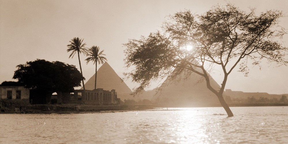
For millennia, July 19 has been considered in Lower Egypt-to be the beginning of the flood. The waters begin to rise and life resumes its cycle just as Egypt and the entire Mediterranean basin and the full summer drought.
Water growth peaks on September 25. Compared to the rainy season in the Ethiopian feeder basin there is a delay corresponding to the time it takes for the flood to propagate. The waters then begin to recede, and when, at the end of October, they begin to turn greenish, it means that the flood is over.
In Cairo, the water level rises during the flood by 8 meters. The daily water intake in the delta is 480 million cubic meters, which is reduced to a few dozen during the lean.
The agriculture and the whole life of Egypt were adapted in ancient times to the rhythm of the floods and the lean times. Hence the importance of controlling them: the nilometers of Asswan and Roda Island served this purpose. In fact, floods and dry spells are not repeated every year with equal values. Egypt's history is full with years that suffered from the capriciousness of the river. In recent era, Asswan's annual averages of 84 billion cubic meters alternated with years with values of just 42 billion (1914) and others with 155 billion (1878-1879).
This also gave rise to the project of "hoarding" the water and regulating the basin with the Asswan barrages and other dams. In antiquity, the Bahr Yussuf, the canal that reached Lake Qarun (Moeris) in the Fayyum depres-sion, contributed to "venting" the excesses.
Almost unbelievably, however, the INTELLIGENCE of modern man has succeeded in modifying and distorting a phenomenon that had been "miraculous" for millennia and millennia: the Great Dam was built at Asswan, which altered the formation of an endless lake that submerged countless fundamental pharaonic vestiges, also proving the land of Egypt of the much precious silt.
A system was set up that allows the production of enormous amounts of electricity and - in theory - to govern irrigation "intelligently," but how much was lost by wanting to replace the wise work of nature ?
Let me cite just two examples:
The world-famous Sphinx of el-Giza, almost 5,000 years old: it is crumbling much more rapidly, due to a cumbersome phenomenon dependent on the low moisture now present in the deeper layers of the soil on which it stands.
The monumental complex of Abu Simbel, despite having been subject like the temple at File to a colossal project that rescued it from the fate that would have made it a spectacular underwater marvel, is fast losing the marvelous co-hues of the polychrome decorations admirable on its walls, thanks precisely to the very high percent moisture produced by the evaporation produced by the endless water mass of Lake Nasser in that place previously virtually devoid of any trace of humidity.


